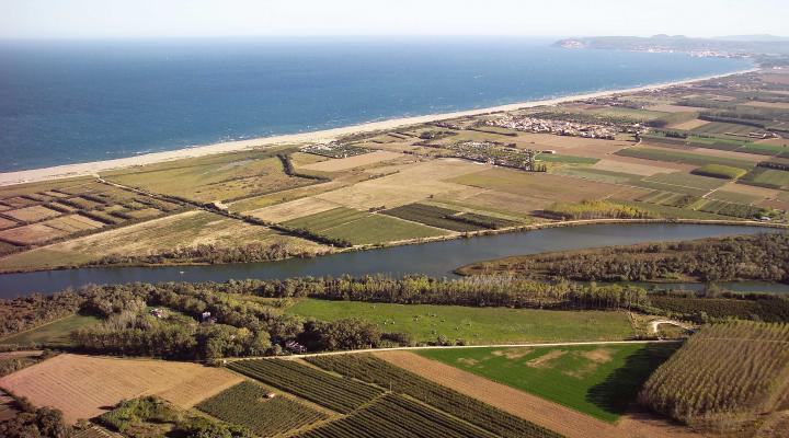
Mig de Dos Rius
Landscape mosaic on the Empordà plane and biodiversity reserve, Mig de Dos Rius (Between Two Rivers) offers a place where nature can be enjoyed and observed. The waters from the Fluvià River, which is omnipresent and serves as the backbone and soul of the space, accompany visitors until they reach the Mediterranean.
ALL THE SPACES IN THE NETWORKGeology
This space is located in the Depression of the Empordà, a wide flat area located in the northeast of Catalonia. It is bordered to the north by the rolling hills on the far western side of the Pyrenees, which dip down into Cap de Creus, and to the other by the ridges of the Precoastal Mountain Range. This depression corresponds to tectonic basins that originated, during the Neogen period, by normal faults that sink rocky blocks and at the same time they are filled with continental or marine sediments.
Southwest of this zone are outcroppings of detrital rocks from the Neogene, most of them clay, sandstone and conglomerates, and to the south are the carbonate rocks from the Mesozoic of El Montgrí massif. The sediments in this space correspond to the river and delta deposits from the Fluvià River and wetland sediments, with silt, sand and organic matter, and it is separated from the coast by barrier beaches and dunes.
The Mig de Dos Rius space is located on the banks of a modern meander. The morphology in this part of the river leads us to believe that the property on the banks of the left branch of the river surrounding Illa de Caramany has become a former branch of the Fluvià River in the past.
